**Oct 2022 Update** We have submitted our detailed technical response to the consultation, as well as an alternative route proposal, to Gloucestershire County Council
At our September committee meeting, we began examining plans for the next section of the Gloucestershire County Council B4063 cycle spine route, between the Estcourt and Elmbridge Roundabouts.
Gloucestershire County Council consulted on their website in September and October 2022.
We’ve previously raised concerns about the singular focus on this route in Gloucestershire and the long delivery timescales, but remain committed to ensuring that it delivers the best possible outcome for those who may use it.
The campaign is currently conducting our own detailed analysis of the proposals, looking at what they deliver in terms of safety, comfort, coherence, and utility, and we will share this in due course.
We have heard that some are struggling to access the plans due to their size/complexity as a pdf. To assist people in engaging with the consultation, we’ve linked below high resolution image files of the plans that may open more easily than the pdfs,
We’ve also created a ‘route mashup’ to download that puts all the plans together so you can see how the whole section connects together.
For measurements, eg on track widths, we would recommend using the original documents provided by the county website, and you can scroll to the bottom of this article to see how to take measurements.
We would love to hear your views to help inform our response. Please feel free to either contact us, or use our social media (facebook/twitter), to share your views.
Gloucestershire Cycle Spine Route ‘mashup’
We’ve created a high resolution (8MB) image file that combines all the proposed plans provided by Gloucestershire County Council so you can scan the route in its entirety.

High resolution individual sheets
This provide simple image conversions of the complex pdfs for the Gloucestershire Cycle Spine route between the Estcourt Roundabout and the Elmbridge Court Roundabout through Longlevens along the B4063 Cheltenham Road. Click to open/download the high resolution versions.
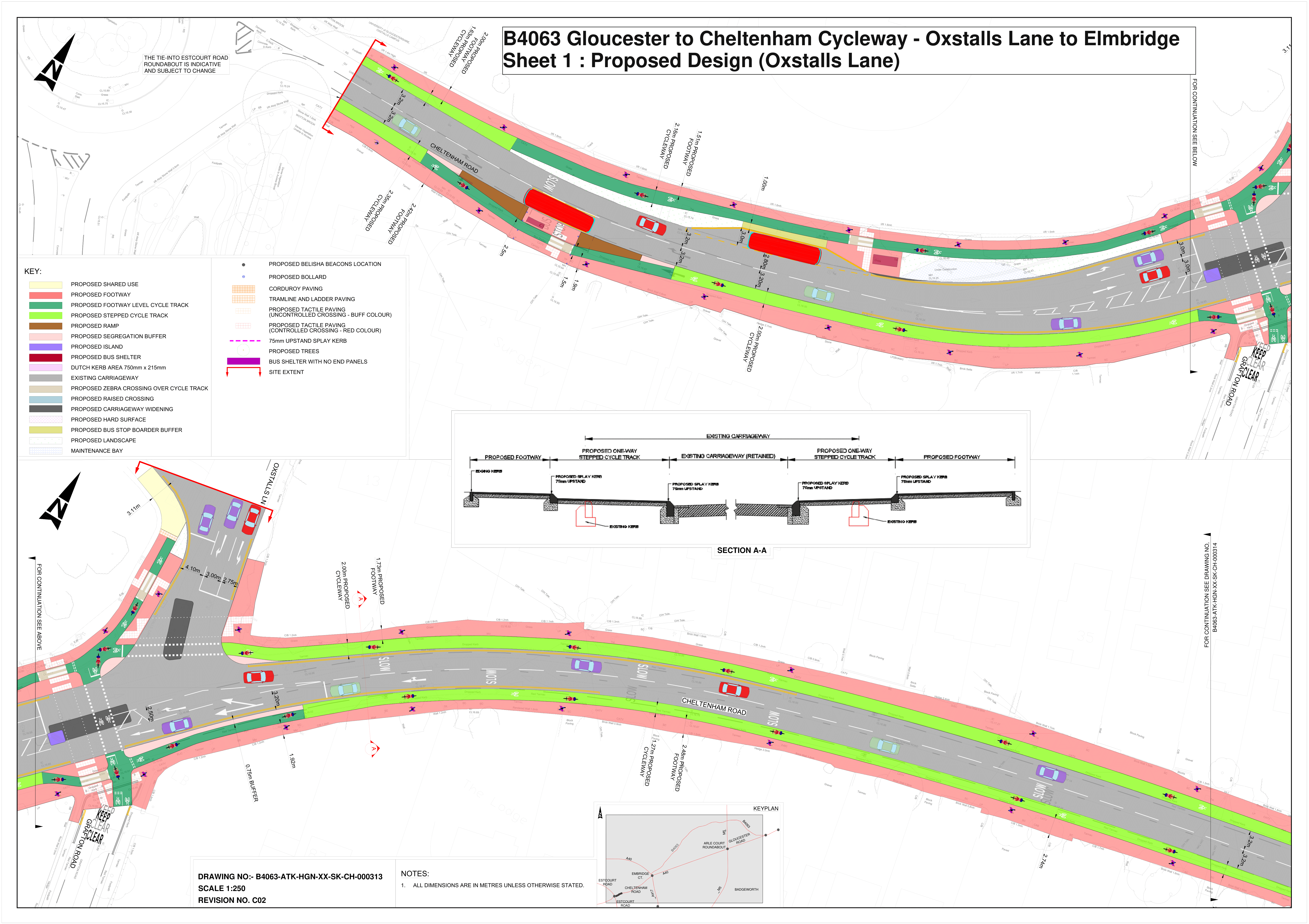
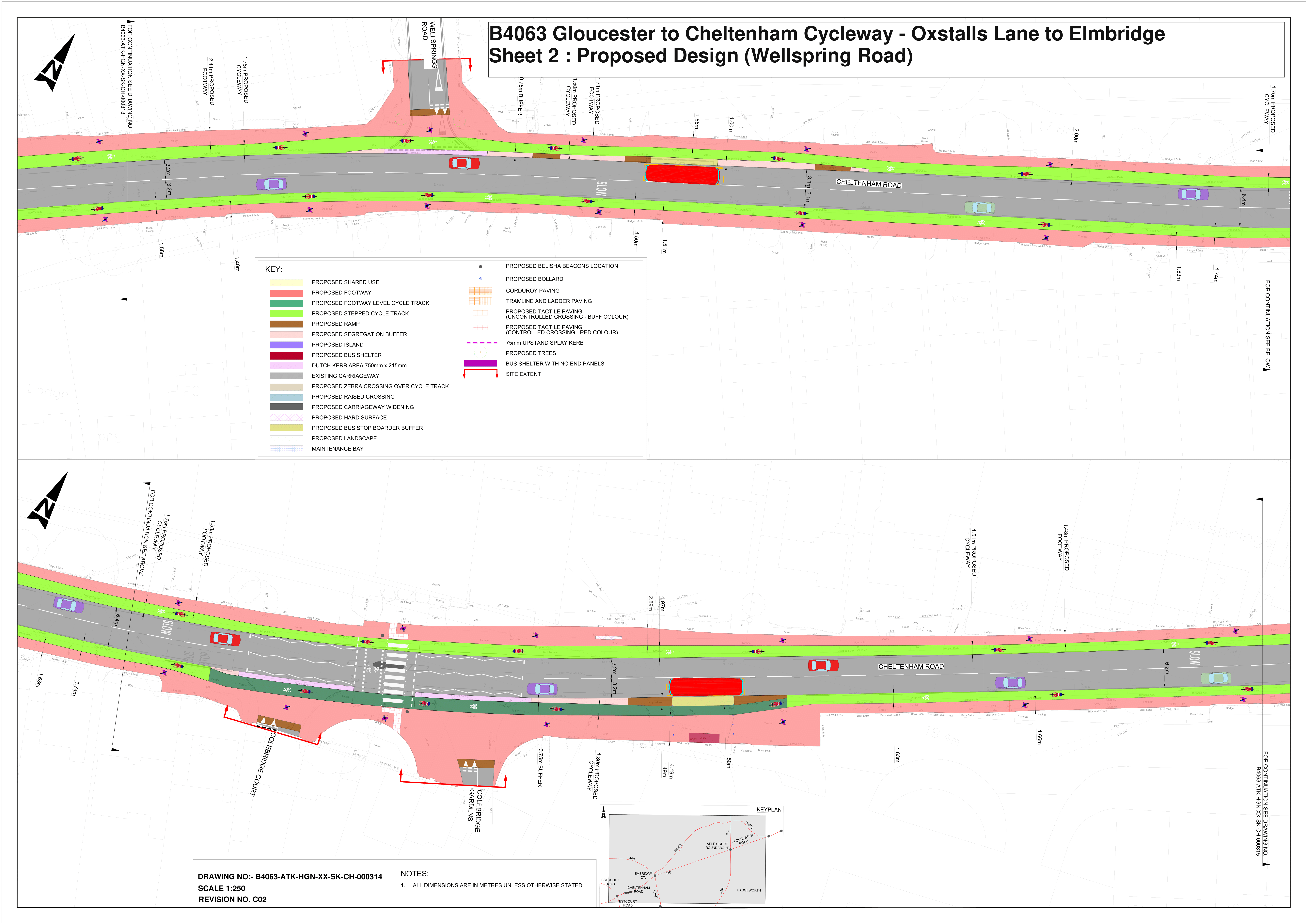
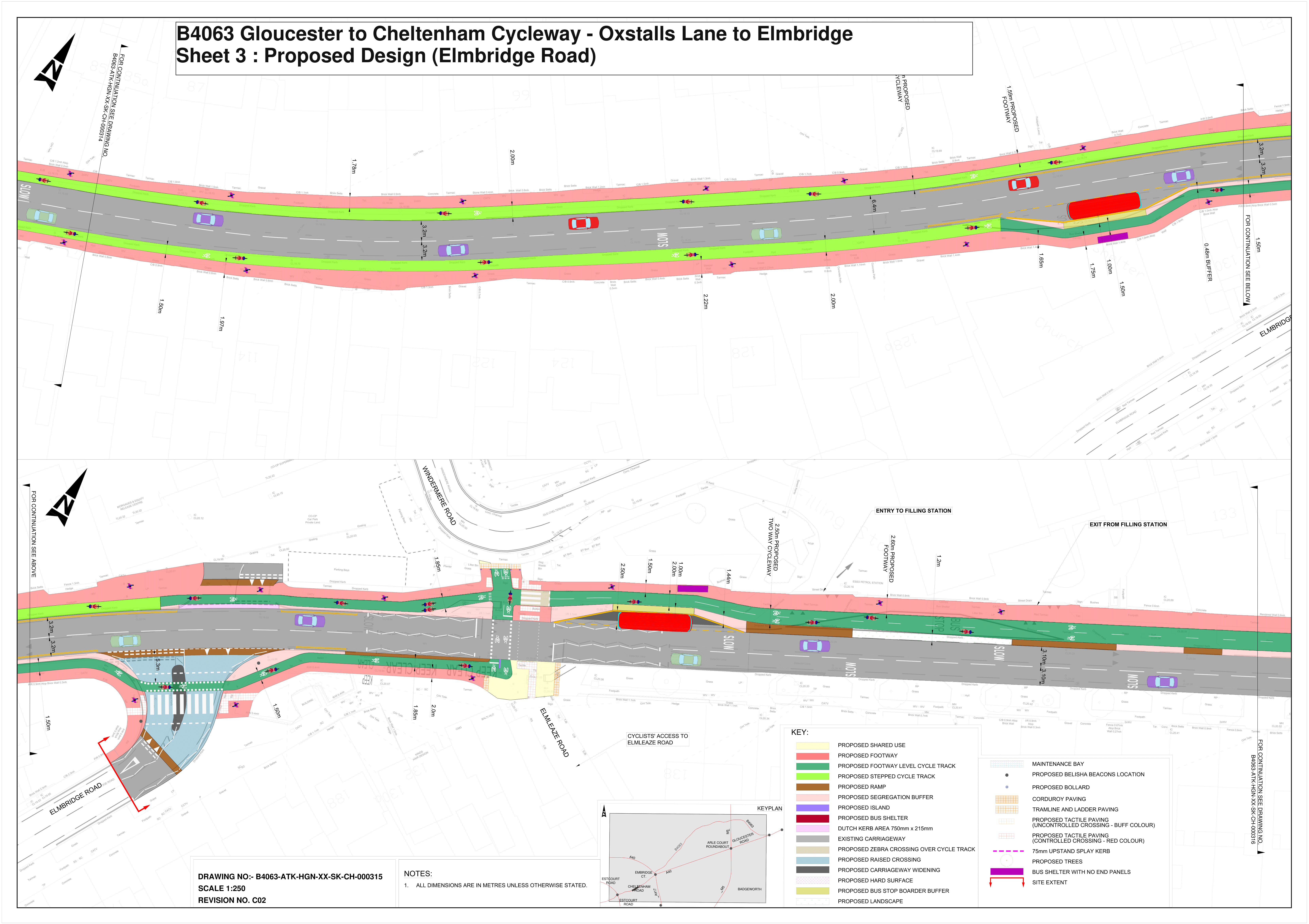
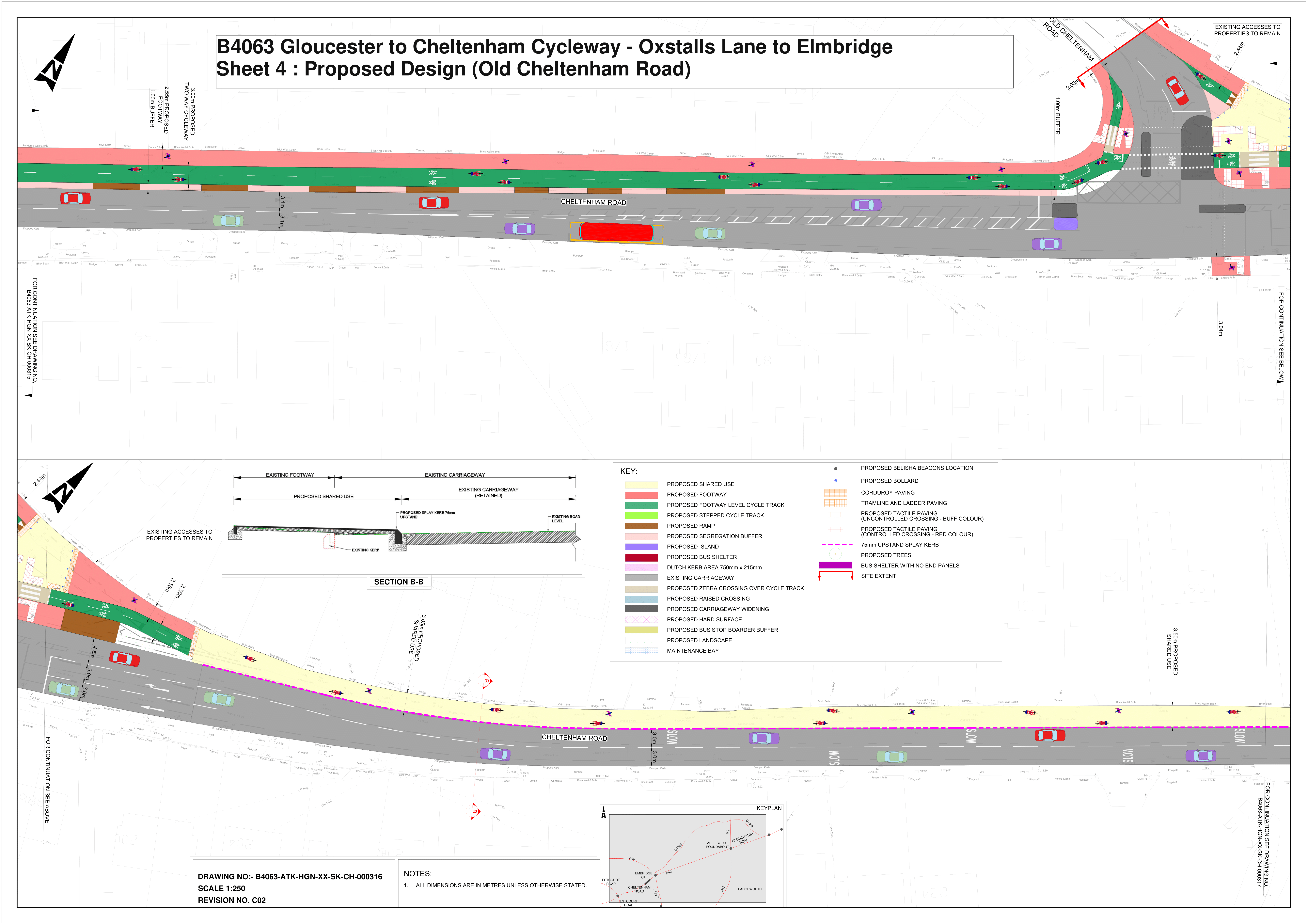
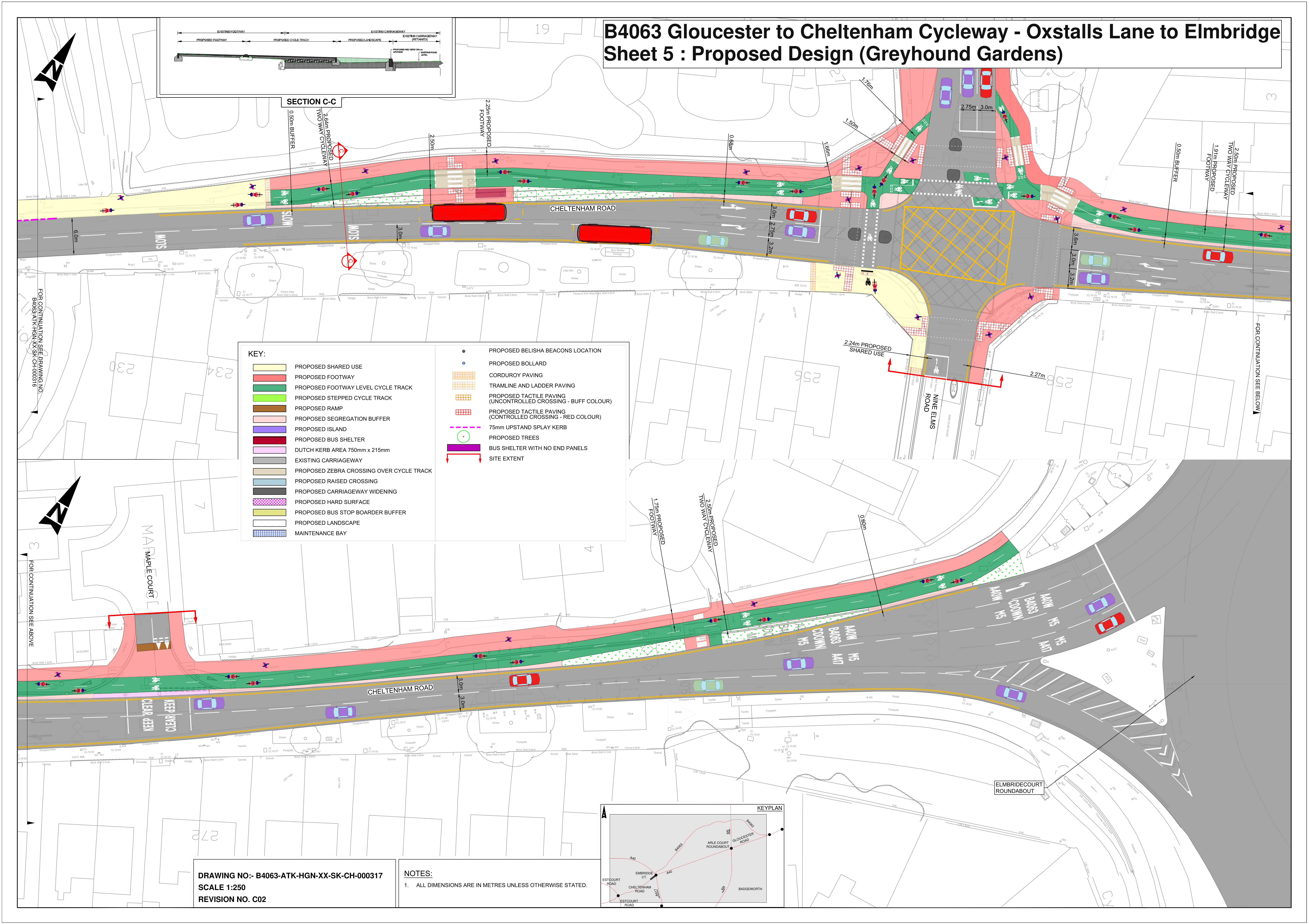
Access the original Gloucestershire Cycle Spine Section 1 plans
The original plans published by Gloucestershire County Council are available on the Gloucestershire Cycle Spine Consultation website.
For details on the other sections, visit the main site page.
To make sure you don’t miss out on all campaign news, including consultation updates, make sure you sign up to our free campaign mailing list.
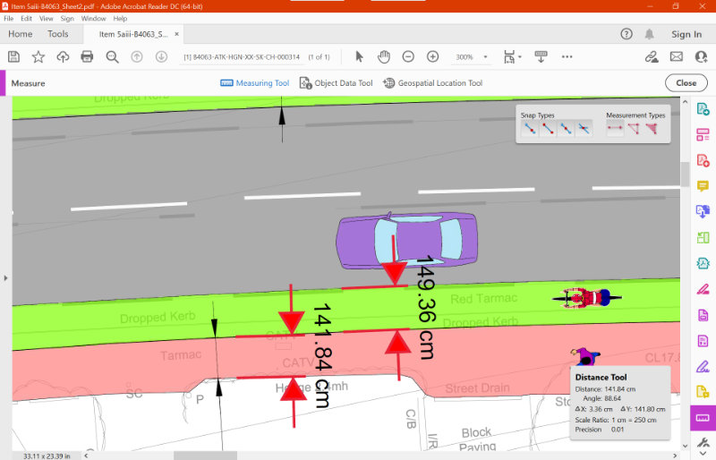
How to take measurements on the plans
One of the areas we’ll be examining in our response is track widths and corner geometry. Check out out guidelines and best practice page to find out what national standards say. If you’d like to do this yourself, you can easily take measurements using Adobe Acrobat DC (free) by following the steps below.
Step 1: Open the pdf version of the plan in Adobe Acrobat Reader DC (free)
Step 2: Find the scale of the drawing – for these plans, it is shown as 1:250
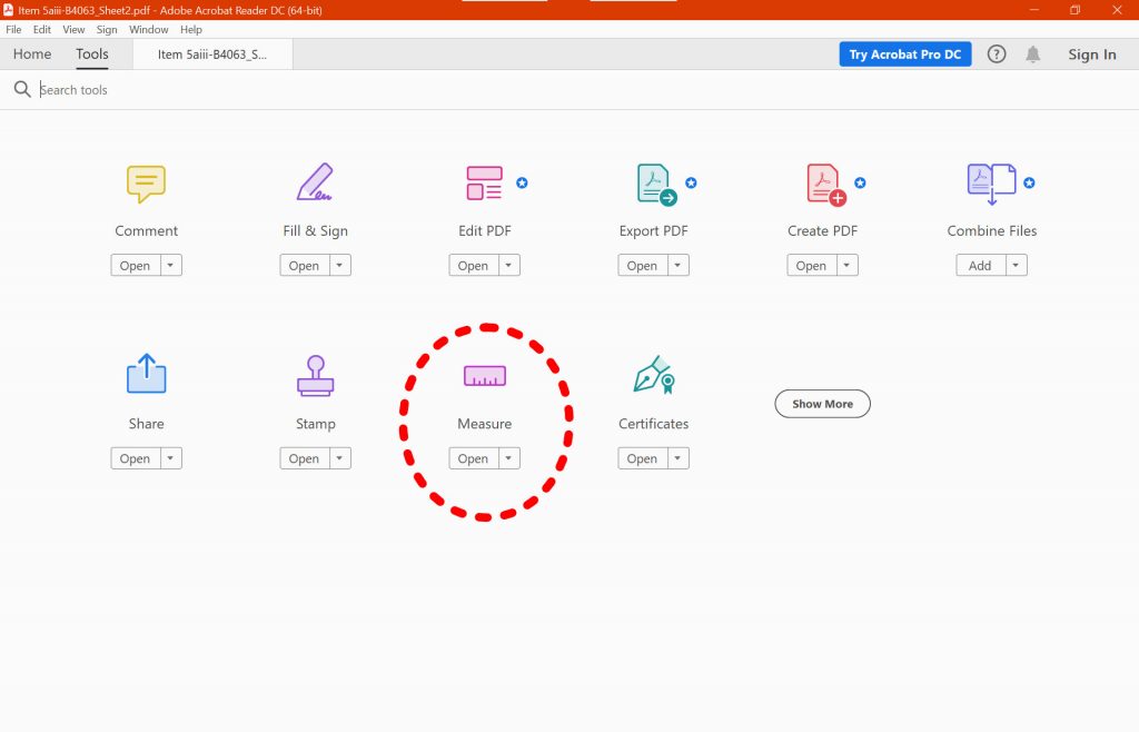
Step 3: Open the measure tool. This isn’t shown by default, but you can access it either by selecting the ‘Tools’ tab at the top, or clicking ‘more tools’ at the bottom of the panel of quicktools on the right.
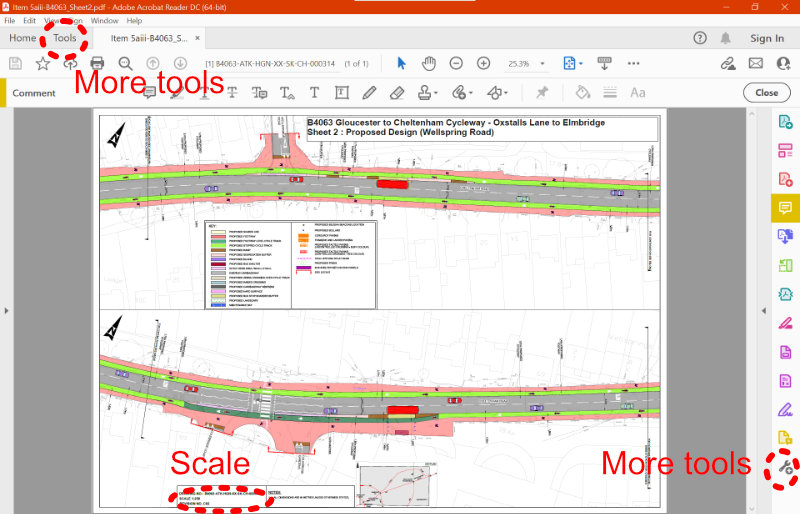
Step 4: Select the ‘measure’ functionality from the toolbox.
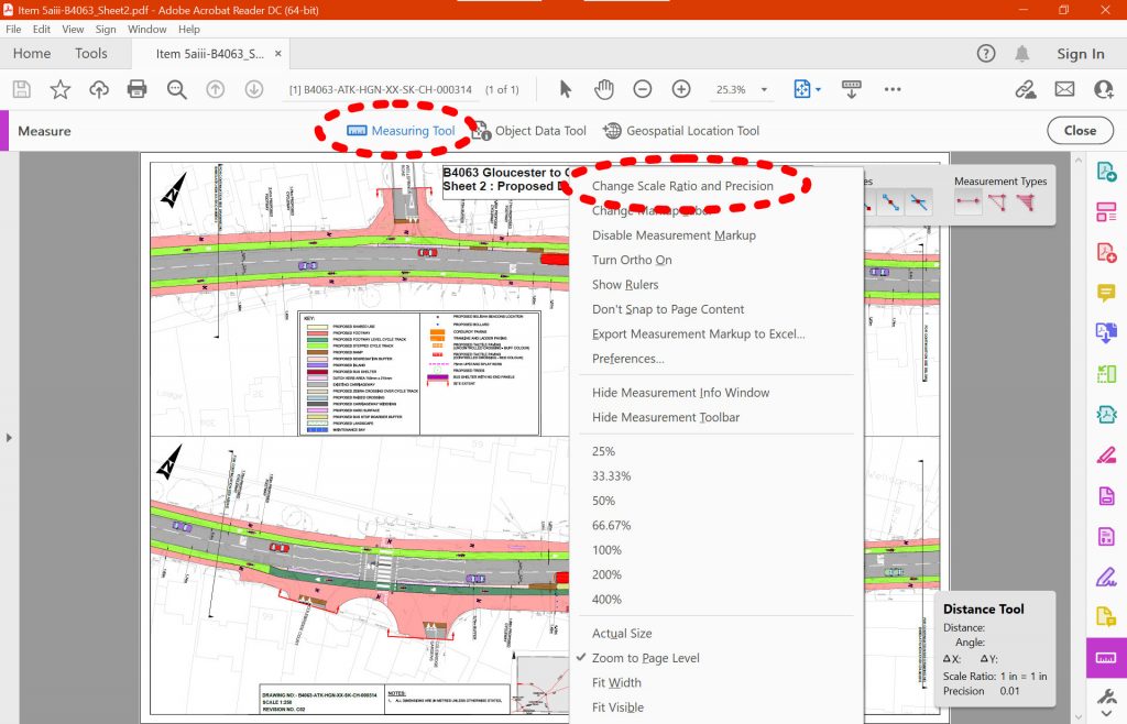
Step 5: Select the ‘measuring’ tool, and then right click on the image to select ‘Change Scale Ratio and Precision’ to enter the scale.
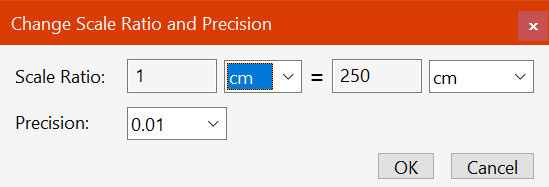
Step 6: Enter the scale as 1cm to 250cm in this example
Step 7: The tool is now set up to use. You can select two points on the plans to take a measurement, and can then drag it out to leave it as a label on the sheet.